
Spatial data provides us with an ability to study complex processes over space and time. Explore my previous works using advance spatial analysis to tackel environmental questions that lead towards solutions.
Yampa River Forest Restoration Project
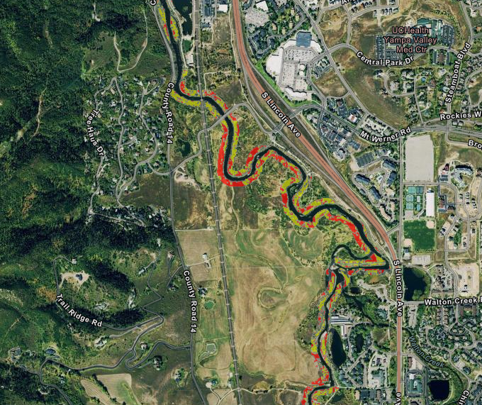
I performed a spatial analyis that idenitfied 275 areas along the Yampa and Elk Rivers riparian coordidors that do not currently benefit from mature forest canopy cover. This project was performed in support of the Yampa River Forest Restoration Project that was started in response to a report finding that seasonally warm water temperature is the biggest water quality issue that the rivers face.
Cluster Analysis
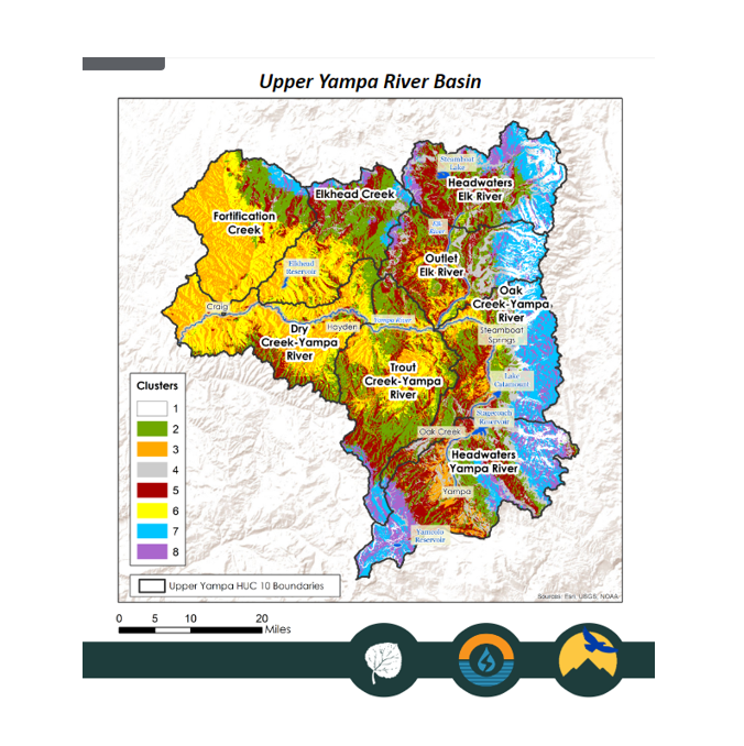
I performed a cluster analysis to identify 8 unique regions that share statistically similar land surface characteristics including elevation, aspect, slope, precipitation and land cover characteristics. This assessment is been used as a tool in designing the Upper Yampa Soil Moisture and Climate Monitoring Network, to help our team place stations in areas that capture variable landscapes across the region.
Mapping Wild Cranberries from Space
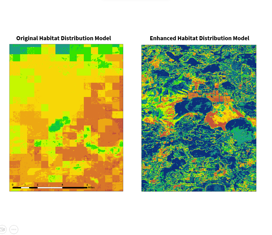
This project was completed under the NASA DEVELOP National Program. My team partnered up with the United States Department of Agriculture’s Agricultural Research Service (USDA ARS) National Plant Germplasm System (NPGS). This project focused on enhancing methdods for mapping crop wild relatives, specifically two species of the Vaccinium L. genus: Vaccinium oxycoccos (small cranberry) and Vaccinium macrocarpon (large cranberry) by incorporating high resolution imagery and spectral indices to their models.
Improved bare ground measurments for the USGS
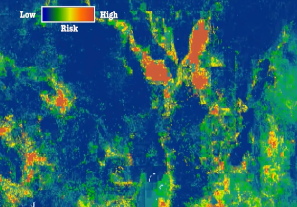
This project was completed under the NASA DEVELOP National Program. My team partnered up with the United States Geologic Survey to improve their habitat risk modeling for Medusahead, an invasive plant species, in Oregon and Nevada, by incoporating enhanced bare ground measurments into their models.